ㅁ Add-on 가능: 고객의 요청에 따라 일정한 범위 내에서 Customization이 가능합니다. 자세한 사항은 문의해 주시기 바랍니다.
ㅁ 보고서에 따라 최신 정보로 업데이트하여 보내드립니다. 배송기일은 문의해 주시기 바랍니다.
한글목차
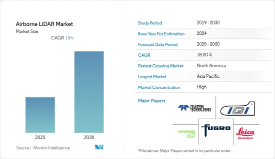
에어본 LiDAR 시장은 예측 기간 동안 CAGR 18%를 기록할 전망입니다.
주요 하이라이트
LiDAR 스캐닝 기술과 공중 배포 플랫폼의 조합을 통해 사용자는 정확한 공간 데이터를 수집하기 위한 뛰어난 효율성과 속도를 얻을 수 있습니다. 그리고 항공우주 및 방위, 광업, 임업, 정밀 농업, 코리도 매핑, 석유 및 가스 등 수많은 산업의 자산 관리 요구를 지원할 수 있게 됐습니다.
Surveying And Mapping LLC.는 첨단 Trimble Harrier 68i 항공 LiDAR 시스템을 SAM의 내부 기능에 추가했습니다. 이러한 시스템과 3가지 레이저 데이터 수집 모드의 조합을 통해 회사는 완벽한 지리공간 솔루션과 LiDAR 서비스 세트를 제공하는 능력을 강화할 수 있었습니다.
무인 항공기의 진화는 진행 상황 추적, 장비 검사 및 구조물 측정과 관련하여 항공 사진이 훨씬 더 큰 관점을 제공하기 때문에 더 큰 잠재력을 보여줍니다. 또한 건설 프로젝트에서 에어본 LiDAR의 사용 증가가 예측 기간 동안 시장 성장을 가속할 것으로 보입니다.
또한, 다양한 최종 사용자 업계 기업들이 임업, 철도, 전기 유틸리티 및 기타 고밀도 용도의 능력과 운영 효율성을 높이기 위해 에어본 LiDAR을 빠르게 채택하고 있습니다. 예를 들어, 유행의 초기 발생 시 Atlantic은 Teledyne Optech의 새로운 Galaxy T2000과 G2 센서 시스템을 사용하여 회사의 OptechGalaxy Prime 에어본 LiDAR 센서를 2개 탑재하여 공중 능력을 강화했습니다.
2021년 11월, 헥사곤의 지오시스템즈는 에어버스와의 파트너십을 발표하여 에어버스 해상 감시기 C295 MSA에 해상 감시용 2개의 Leica Chiroptera 4X 수심계 LiDAR 센서를 통합했습니다. 이 기술은 비행 중에 실시간으로 LiDAR 데이터를 시각화하고 분석할 수 있는 물체 감지 기능을 갖추고 있습니다.
또한 높은 상세도와 정확성을 유지함으로써 에어본 LiDAR는 건물과 도시 전체를 3D 스캔할 수 있습니다. 이러한 위치의 정확한 복제본을 생성하는 이러한 라이더의 능력은 3D 모델링의 시간과 비용을 줄이고 보다 현실적인 시각 효과를 만드는 데 도움이 됩니다. 이는 미디어 및 엔터테인먼트 산업을 위한 솔루션을 제공하는 다양한 기업을 더욱 자극하고 있습니다.
에어본 LiDAR 시장 동향
항공우주 및 방위가 최대 점유율을 차지
항공기, UAV 및 헬리콥터에 에어본 라이더를 배치하기 위한 이 분야의 규제 기관의 투자 증가는 예측 기간 동안 시장 성장을 가속할 것으로 예상됩니다. SIPRI에 따르면 미국은 2021년에 군사비가 가장 많은 나라의 선두에 서서 8,010억 달러가 군사비에 충당되었습니다고 합니다. 이는 같은 해 세계 군사비의 38%를 차지했으며, 그 총액은 2조 1,000억 달러에 달했습니다.
예를 들어, 2021년 11월 독일의 신흥 기업인 Evitado Technologies는 항공기 충돌을 방지하는 획기적인 시스템을 개발했습니다. 이 회사의 LiDAR 기술은 지상의 움직임으로 인한 항공기 손상을 방지할 수 있습니다. 하이테크 센서 시스템은 비행기와 견인차에 일시적으로 설치할 수 있습니다. 이 고급 시스템은 360도 시야에서 항공기 주변을 지속적으로 모니터링하고 충돌 위험이 높은 경우 운영자에게 경고합니다.
LiDAR 기술은 여러 응용 분야에서 3D 데이터를 검색하는 데 사용됩니다. 상세한 도시와 비도시의 지형 매핑은 하늘에서 군사 작전과 반자율 주행 차량에 도움이 됩니다. 스웨덴 국방연구기관(FOI)은 R&D 목적으로 다양한 멀티로터 UAV에 장착된 공중 센서 시스템, 특히 3D 이미지 라이더의 가능성을 입증하기 위해 노력해 왔습니다.
게다가 2022년 7월, Fugro는 국가 해상 안전국(NMSA)과 공동으로 해도의 갱신과 연안역 관리의 개선에 이용되는 조사를 실시했습니다. 파푸아 뉴기니에서는 스타 리프 항로를 안전하게 통과하기 위한 수로 조사를 완료했습니다. 이 회사는 LADS HD 항공 LiDAR 수심 측량(ALB) 시스템을 사용하여 NMSA와 Fugulo 측량 팀에 의해 개발되었습니다.
또한, 대지뢰전용 공중 레이저 지뢰감지시스템(ALMDS) 등 삼림수관 및 기타 장애물을 통한 목표와 움직임을 파악하기 위한 세부사항을 수집하기 위해 고해상도 시스템을 배치 되었습니다. 단거리 LiDAR은 위험한 장소에서 가스, 액체 및 기타 생물학적 위협의 존재를 인식합니다. 신속하게 감지하고 실시간으로 대응할 수 있는 능력을 통해 LiDAR 기술은 업계에서 구현되는 다른 선행 기술보다 더 큰 이점을 제공합니다.
북미가 큰 점유율을 차지할 전망
북미는 에어본 LiDAR의 기술 혁신을 가속화하는 투자가 증가하고 있기 때문에이 기술의 주요 개발 국가 중 하나입니다. 이러한 유형의 LiDAR 시스템은 특히 엔지니어링, 건설, 환경 및 탐사 용도으로 많은 산업에서 채택되어 있으며, 이 기술의 효율성과 그에 따른 수요를 입증합니다.
게다가 지금은 사람이 살지 않는 경관이나 유적 등을 특정하기 위한 고고학에서 항공 LiDAR의 채용이 증가하고 있으며, 예측 기간 동안 이 지역에서의 기술 채용을 촉진할 것으로 예상되고 있습니다. 2022년도 국방수권법에 따르면, 의회는 미사일 방위청에 탄도 미사일 방어나 극초음속 미사일 방위 응용에 사용하는 레이저 기술을 연구 개발할 권한을 부여하고 있습니다.
이 지역의 주요 기업 중 일부는 타사에 대한 경쟁 우위와 선행자 이익을 제공하는 기술을 개발해 왔습니다. 이것은 예측 기간 동안 항공 LiDAR의 성장을 가속할 것으로 예상됩니다. 게다가 2021년 3월, L3Harris Technologies는 미국 육군의 Abrams Gunner's Primary Sight를 위한 아이세이프 레이저 레인지 파인더(LRF) 프로토타입을 제공하는 계약을 획득했습니다. 이 회사에 따르면, 레인지 파인더는 안개, 연기, 먼지, 모래, 연무와 같은 전장 조건 하에서 탱크 내에서 범위를 설정할 수 있습니다.
또한 2021년 3월 Northrop Grumman은 고에너지 레이저 스케일링 이니셔티브(HELSI)를 통해 Northrop Grumman의 코히런트 빔 컴바이닝 기술을 사용하는 고에너지 레이저 프로토타입을 입증하기 위해 7,200만 달러의 DoD(미국 국방부) 계약을 획득했습니다.
에어본 LiDAR 산업 개요
Teledyne Technologies 및 IGI Systems와 같은 주요 기업이 있기 때문에 항공 LiDAR 시장의 기업간 경쟁이 치열합니다. 각 회사는 R&D 활동을 통해 경쟁 우위를 확보하고 있습니다. 전략적 파트너십과 M&A를 통해 각 회사는 시장에 더 큰 발자국을 남길 수 있었습니다.
2021년 11월 - 헥사곤의 지오시스템즈 부문은 에어버스와의 협업에 의해 에어버스의 C295 MSA(해상 감시기)에 해상 감시용의 라이카 Chiroptera 4X 수심계 LiDAR 센서 2대를 통합한다고 발표했습니다.
2021년 9월 - Yellow Scan은 완전 자동화된 20Mpx 카메라 모듈을 탑재하고 ApplanixAPX-15 UAV 관성 네비게이션 시스템과 조합한 온보드 LivoxAVIA 레이저 스캐너를 탑재한 Mapper를 발표했습니다.
기타 혜택 :
엑셀 형식 시장 예측(ME) 시트
3개월의 애널리스트 서포트
목차
제1장 서론
조사의 성과
조사의 전제
조사 범위
제2장 조사 방법
제3장 주요 요약
제4장 시장 역학
시장 개요
시장 성장 촉진요인
드론 기술의 진보
다양한 산업에서 견고한 모니터링 시스템에 대한 요구 증가
시장 성장 억제요인
높은 설비 비용
업계의 매력 - Porter's Five Forces 분석
신규 참가업체의 위협
구매자의 협상력
공급기업의 협상력
대체품의 위협
경쟁 기업 간 경쟁 관계의 강도
시장에 대한 COVID-19의 영향
제5장 시장 세분화
유형별
지형 LiDAR
수심 측정 LiDAR
제품별
하드웨어
서비스별
최종 사용자 산업별
항공우주 및 방위
광업
임업 및 정밀농업
코리도 매핑
석유 및 가스
기타 최종 사용자 산업
지역별
북미
유럽
아시아태평양
라틴아메리카
중동 및 아프리카
제6장 경쟁 구도
기업 프로파일
Teledyne Technologies
Leica Geosystems(Hexagon AB)
Fugro
IGI Systems
Photomapping Services Pty Ltd
Merrick & Company
Velodyne Lidar Inc
AAM Pty Ltd
Airborne Imaging Inc
Surveying and Mapping, LLC.
제7장 투자 분석
제8장 시장의 미래
KTH
영문 목차
영문목차
The Airborne LiDAR Market is expected to register a CAGR of 18% during the forecast period.
Key Highlights
The combination of LiDAR scanning technology with an aerial deployment platform has enabled the user to extract extraordinary efficiency and speed for gathering accurate spatial data allowing him to support asset management needs for numerous industries such as Aerospace & Defense, Mining, Forestry & Precision Agriculture, Corridor mapping, oil & Gas.
Surveying And Mapping LLC., with the addition of the state-of-the-art Trimble Harrier 68i airborne LiDAR system to SAM's in-house capabilities. These systems in combination with the three different modes of laser data collection, have enabled the company to enhance its ability to provide complete geospatial solutions and a full suite of LiDAR services.
The evolution of drones further displays huge potential as aerial photos provide a much bigger perspective when it comes to tracking progress, inspecting the equipment, and measuring structures. Also, the increased usage of airborne lidars in construction projects is expected to drive market growth over the forecast period.
Further, companies across various end-user industries are adopting airborne lidars rapidly, to enhance their capability and operational efficiency for forestry, rail, electrical utilities, and other high-density applications. For example, during the early onset of the pandemic, Atlantic used Teledyne Optech'snew Galaxy T2000 and G2 sensor system to enhance its airborne capability by accommodating two of the company's OptechGalaxy Prime airborne lidar sensors.
In November 2021, Hexagon's Geosystems announced partnerships with Airbus to integrate two Leica Chiroptera 4X bathymetric LiDAR sensors for maritime surveillance into the C295 MSA, Airbus' Maritime Surveillance Aircraft. The technology has an object detection feature that enables real-time LiDAR data visualization and analysis during the flight
Moreover, maintaining a high level of detail and accuracy, the airborne lidars can even scan buildings or an entire city in 3D. These lidars' ability to generate the exact replicas of such locations helps to reduce the time and cost of 3D modeling and assists in creating more realistic visual effects. This further stimulates various companies to provide solutions for the media and entertainment industry.
Airborne LiDAR Market Trends
Aerospace & Defense to Hold the Largest Share
The increasing investments by the regulatory bodies of the sector for the deployment of airborne lidars on aircraft, UAVs, and helicopters are expected to fuel the market growth over the forecast period. According to SIPRI, the United States led the list of countries with the highest military spending in 2021, with USD 801 billion dedicated to the military. This accounted for 38% of global military spending that year, which totaled 2.1 trillion US dollars.
For instance, in November 2021, Evitado Technologies, a German startup, created a revolutionary system to prevent aircraft collisions. Their LiDAR technology can prevent aircraft damage caused by ground movement. A high-tech sensor system can be temporarily installed on an airplane or tow vehicles. The sophisticated system continuously monitors the area around the aircraft with a 360-degree field of view and alerts the operator for a high risk of collision.
LiDAR technology is being used for 3D data capture for several applications. Detailed urban and non-urban terrain mapping can benefit military operations from the air and semi-autonomous vehicles. Swedish Defense Research Agency (FOI) has been working on demonstrating the possibilities for airborne sensor systems, especially 3D imaging lidar on different multi-rotor UAVs, for research and development purposes.
Further, in July 2022, Fugro collaborated with the National Maritime Safety Authority (NMSA) on the survey, which will be used to update nautical charts and improve coastal zone management. It has completed a hydrographic survey in Papua New Guinea to determine a safe passage through the Star Reef Passage. The company used its LADS HD+ Airborne Lidar Bathymetry (ALB) system, which was deployed by a team of surveyors from the NMSA and Fugro.
Further, higher resolution systems are deployed to collect details to identify targets and movement through the forest canopies and other obstacles, such as Airborne Laser Mine Detection Systems (ALMDS) for counter-mine warfare. Short-range LiDARsrecognize the presence of gases and liquids and other bio-threats in hazardous locations. The ability to detect rapidly and respond in real time gives LiDAR technology a significant edge over the other conventional technologies implemented in the industry.
North America is Expected to Hold Significant Share
North America is one of the key developers of the technology, due to the increasing investments in accelerating innovations in the Airborne LiDAR landscape. These types of LiDAR systems are adopted by many industries, especially for application in engineering, construction, environment, and exploration, proving the effectiveness and, therefore, demand for this technology.
Additionally, the increasing adoption of airborne lidars in archeology to identify the now-unpopulated landscape, ruins, and many more are expected to fuel the adoption of the technology in the region over the forecast period. As per the fiscal 2022 National Defense Authorization Act, Congress is granting the Missile Defense Agency authority to research and develop laser technology for use in ballistic and hypersonic missile defense applications.
Some of the key players in the region have developed the technology that has provided them with a competitive advantage over others and the first mover's advantage. This is expected to fuel the growth of airborne lidars over the forecast period. Further, in March 2021, L3Harris Technologies has rewarded a contract to furnish eye-safe laser range finders (LRF) prototypes for the US Army's Abrams Gunner's Primary Sight. According to the company, the range finders allow the operator to establish ranges from inside the tank in battlefield conditions such as fog, smoke, dust, sand, and haze.
Furthermore, in March 2021, Northrop Grumman was awarded a USD 72 million DoD (U.S. Department of Defense) contract through the High Energy Laser Scaling Initiative (HELSI) to demonstrate a high-energy laser prototype that will use Northrop Grumman's coherent beam combining technology.
Airborne LiDAR Industry Overview
The competitive rivalry amongst the players in the airborne lidar market is high owing to the presence of some key players, such as Teledyne Technologies and IGI Systems, amongst others. The players have gained a competitive advantage through research and development activities. Strategic partnerships and mergers & acquisitions have enabled the companies to achieve a more substantial footprint in the market.
November 2021- Hexagon's Geosystems division announced a collaboration with Airbus to integrate two Leica Chiroptera 4X bathymetric LiDAR sensors for maritime surveillance into Airbus' C295 MSA, Maritime Surveillance Aircraft.
September 2021 - Yellow Scan introduced a Mapper+, which comes with a fully automatized 20 Mpxcamera module and has an onboard LivoxAVIA laser scanner combined with the ApplanixAPX-15 UAV inertial navigation system.
Additional Benefits:
The market estimate (ME) sheet in Excel format
3 months of analyst support
TABLE OF CONTENTS
1 INTRODUCTION
1.1 Study Deliverables
1.2 Study Assumptions
1.3 Scope of the Study
2 RESEARCH METHODOLOGY
3 EXECUTIVE SUMMARY
4 MARKET DYNAMICS
4.1 Market Overview
4.2 Market Drivers
4.2.1 Advancements in Drone Technology
4.2.2 Increasing Need for Robust Surveillance Systems across Various Industries
4.3 Market Restraints
4.3.1 High Equippment Cost
4.4 Industry Attractiveness - Porter's Five Forces Analysis